Document Actions
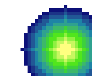
Sediment dispersal
A possible candidate for sediment dispersal model. Extremely simplified.
A quick hack to perform multi-ring buffers in GRASS and threshold based on area
Some initial setup:
 r.in.gdal in=/cygdrive/f/dev/ca/pours/a_pour out=pour location=pour_test
 g.mapset mapset=PERMANENT location=pour_test
 r.in.gdal in=/cygdrive/f/dev/ca/bb_land2 out=de
 r.null map=dem null=-99
 r.mapcalc ocean='if(dem<0, 1, null()'
 r.null map=dem setnull=-99

 g.region -p
    projection: 0 (x,y)
    zone:       0
    north:      -2919271.69459491
    south:      -3227421.19533351
    west:       -1358927.47531673
    east:       -913519.64239073
    nsres:      908.9955774
    ewres:      908.9955774
    rows:       339
    cols:       490
Next, we want to generate the buffer. We need to do whatever the maximum distance would be assuming 1 cell dispersal per ring.
For example, if our input sediment was 100 tons, and we had a decay of 5 tons × cell-1, then we'd need 100 / 5 = 20 cells out.
Generate these classes as multiples of the nsres, but precision isn't necessary since the buffer op will around to the nearest cell.
r.buffer in=pour out=pour_buffer distances=910,1820,2730,3640,4550,5460,6340,7280,8200,9100,10010,10920
r.mapcalc pour_zones = 'if(pour_buffer && ocean, pour_buffer)'

From this, we can calculate the stats on how much area is contained within each distance class (the categories represent distance classes from the pour point). Then, if we can come up with a general formula for input sediment -> areal dispersion, we can use the multiple ring buffer out to the distance where we would no longer have sediment to distribute.
r.stats -a pour_zones
  2 826272.959733
  3 826272.959733
  5 826272.959733
  6 1652545.919466
  7 2478818.879198
  8 2478818.879198
  9 1652545.919466
  10 2478818.879198
  11 1652545.919466
  12 826272.959733
  13 1652545.919466
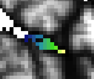
Final output with DEM background